Showing posts with label sea ice. Show all posts

Thursday, October 25, 2012

Polar sea ice sets two records

On August 26th this year, Arctic sea ice extent fell to its lowest ever since records began in 1979. Sea ice continued to melt into September reaching a minimum of 3.41 million square kilometers on the 16th of September. Which is 790 thousand square kilometers less than the previous record minimum (2007) and roughly half the average minimum from 1979 to 2000 (7.04 million square kilometers).

At the other end of the planet Antarctic sea ice was setting a new winter maximum of 19.44 million square kilometers on the 26th of September. Which is 740 thousand square kilometers more than the 1979 to 2000 average maximum (18.7 million square kilometers). So the gain in the south is far lower than the loss in the north. And the gain in the Antarctic is no cause for celebration.

Antarctic sea ice extent on the 26th of September when the record maximum was set (image NSIDC)
The gain in sea ice in the Antarctic is likely to be due to two effects. The hole in the ozone layer has a cooling effect on the continent because ozone is a greenhouse gas. Warming in the Southern Ocean, which is well documented, has also lead to an increase in the strength of westerly winds. This has pushed more sea ice away from shore expanding its extent in most places except the Antarctic peninsula where it has decreased.

Thursday, August 30, 2012

Lowest ever Arctic sea ice cover

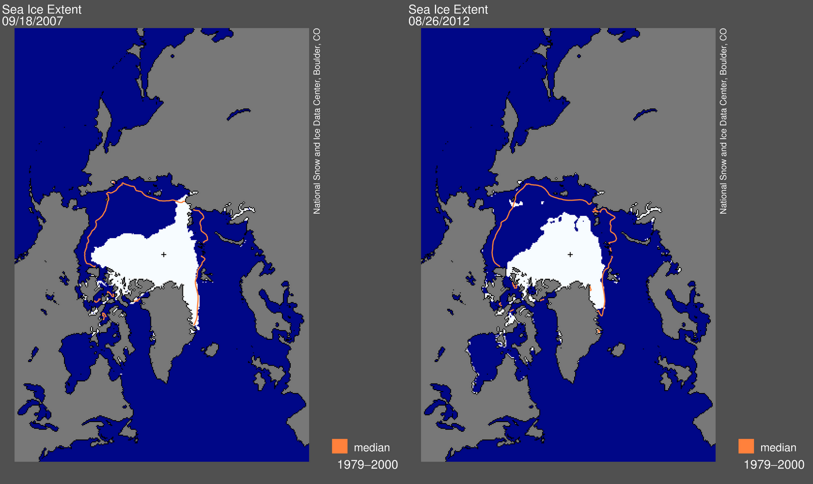
In the northern summer of 2007 the extent of Arctic sea ice reached a low of 4.17 million square kilometers, the lowest since satellite measurements began in 1979. A few days ago the extent of Arctic sea ice was just 4.10 million square kilometers, just breaking the 2007 record. But, the ice is likely to keep melting well into September. 

The minimum sea ice coverage of 2007, recorded on September 18 (left) next to the new record set on August 26 this year (right). Previous years suggest that ice will continue to melt until mid-September (image NSDIC).
Of concern is that this year was cooler than 2007. However, the extent of sea ice coverage measures just two of the three important dimensions. Like its area, the thickness of sea ice has also been falling. This means that the loss of ice area is accelerated because there is a smaller volume that needs to melt. 

Arctic sea ice volume estimated from ice extent and thickness data (image Wikipedia).
The ice loss exposes a greater expanse of open water, which feeds back via two mechanisms to further accelerate ice loss. The sea ice reflects sunlight back into space and as more dark water is exposed more energy is absorbed, which raises temperature. Larger areas of open ocean also allow storms to generate larger waves that break up the ice into smaller pieces, which melt faster.

Of note is that the six years with the lowest Antarctic ice covers are the last six years. Listed from lowest to highest ice cover, they are 2012, 2007, 2011, 2008, 2010 and 2009. To round out the top ten years with the least ice cover add 2005, 2006, 2002 and 2004 to the list. That's right, the top ten years of lowest sea ice cover have occurred in the last eleven years. And 2003 sits at number twelve after 1995.